The Movement of Light
The Transportation Network
The circular transportation network is on average shorter from any point to any other point ​than an equivalent size grid transportation network. And there's no stop-start intersections, reducing energy spent and saving time and stress.
The circular transportation network can also be an information highway for the internet and potentially for transporting renewable energy and powering electric vehicles.
A 4.5 kilometre map showing the cicular transportation network.
With everything we need less than 4 km of where we live for 73.4% of the population and 5.6 km for everyone. Walking, cycling or e-bikes and mobility scooters are ideal for day to day needs. For the occasional long journey a faster transportation system may be needed. But it would need to be contained to prevent killing bugs and birds and other animals. (See More)
Map showing the distances from villages to town.
From each village to the nearest town centre.
Less than 800 m. Less than 1.6 km. Less than 2.4 km.
Less than 3.2 km. Less than 4 km. Less than 4.8 km.
Less than 5.6 km.
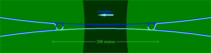
The midsection of the intersection is a bridge or tunnel to allow life to move between nature places.
Map of intersection.

The hexagonal shaped village is fine for many places but for places with large animals the circle or the triangle shaped villages may be better as they have wider nature corridors. The downside is they have a smaller central space for nature and transportation goes through more of nature.

Three different shaped villages. A hexagon, a circle and a triangle.
Back to 'The Thousand Year Plan'
A graphic representation of light that looks like 216 happy faces.
Kane J Fielding CC 2018 @kainuititirangi - Link to Creative Commons website.